Rochdale Moors and Reservoirs
Raw, atmospheric Pennine scenery at its most uncompromising- Walk a section of the historic Cotton Famine Road, hand-built in the 1860s by unemployed weavers- Big views west into Lancashire and east into Yorkshire from the ridgeline- Quieter than many Pennine routes - you will often have the moor to yourself
Effort: Good distance, solid climb
Underfoot: Technical, navigation required
E3·T4 — how we grade routesRaw, atmospheric Pennine scenery at its most uncompromising- Walk a section of the historic Cotton Famine Road, hand-built in the 1860s by unemployed weavers- Big views west into Lancashire and east into Yorkshire from the ridgeline- Quieter than many Pennine routes - you will often have the moor to yourself
A demanding moorland traverse on the Lancashire-Yorkshire border, crossing exposed Pennine ridges, following the historic Cotton Famine Road and dipping past dark gritstone reservoirs.
Rochdale Moors and Reservoirs
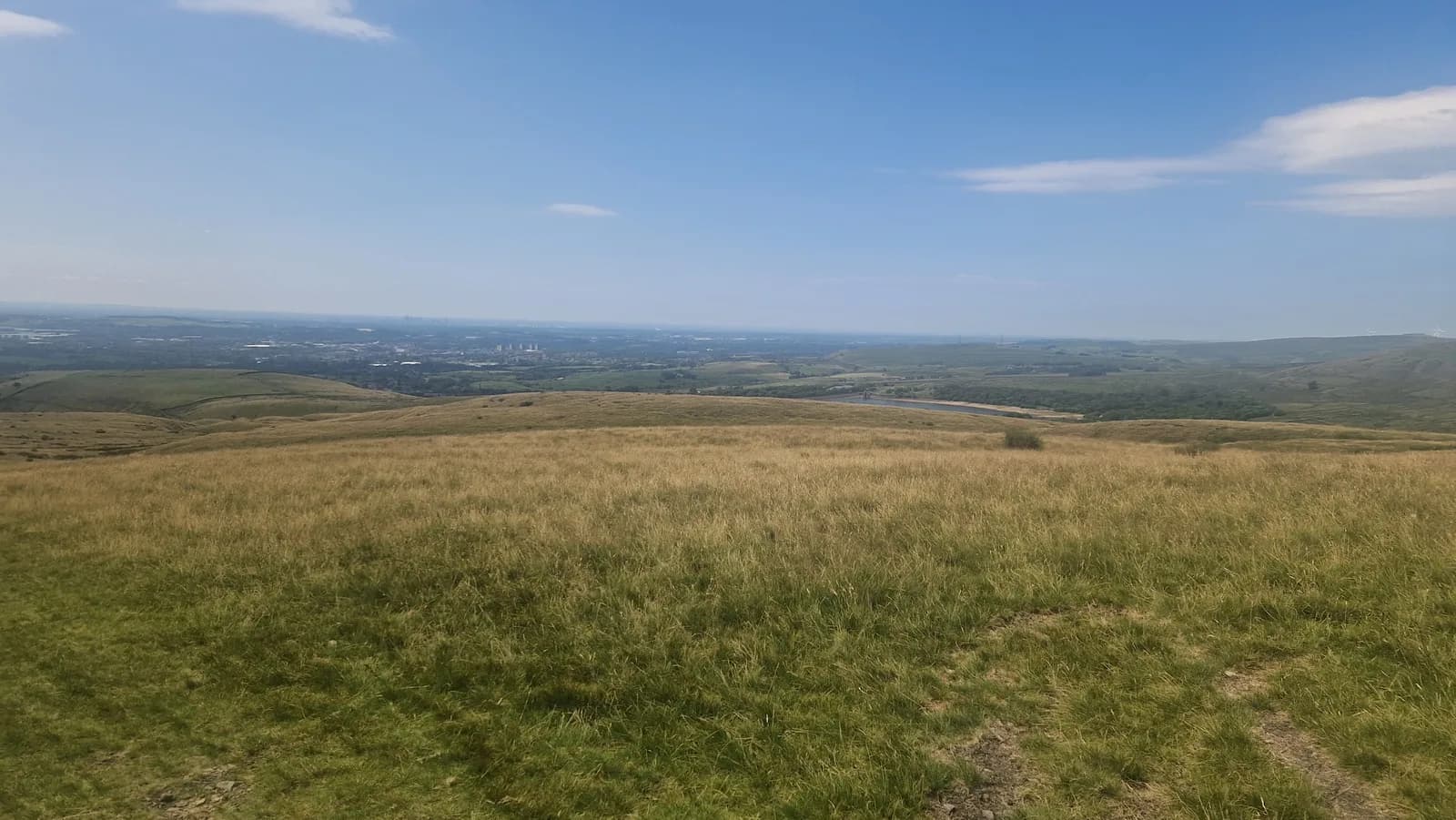
This 19.5 km route crosses some of the finest and least-visited moorland in the Southern Pennines, covering the high ground above Rochdale between Blackstone Edge and Rooley Moor. It is a serious day out that demands good navigation skills and appropriate gear, but rewards those who come prepared with solitude and scenery in equal measure.
The walk sets out across open grouse moor, gaining height steadily on firm peat tracks before reaching the exposed ridge of Blackstone Edge at 472 m. This is Pennine Way country - the boundary stone and the ancient packhorse road that crosses the ridge here have been guiding travellers between Lancashire and Yorkshire for centuries.
From the ridge, the route follows the historic Cotton Famine Road (also known as Rooley Moor Road), a remarkable track built in the early 1860s under a public works programme to provide employment to weavers thrown out of work by the American Civil War's disruption of cotton supplies. The original cobbles are still visible beneath your feet on the highest sections.
The middle section descends into the deep cleft of the Spodden Valley before climbing back onto the moor via Healey Dell, where a Victorian viaduct spans the gorge above an 18-metre waterfall.
The return runs above a chain of dark-water reservoirs that fill the moorland hollows, with the lights of Rochdale visible in the valley below on the descent.
Key Facts
- Distance: 19.5 km (12.1 miles)
- Ascent: 483 m
- Terrain: Moorland, historic cobbled track, valley paths
- Start/Finish: Rooley Moor Road near Summit (OL12 6BN)
- Navigation is difficult in mist on the high moorland - OS map and compass essential
- Exposed ridgeline; weather can change quickly; wind chill significant in winter
- Some boggy sections on the Cotton Famine Road are unavoidable in wet conditions
- Limited escape routes from the high moor


