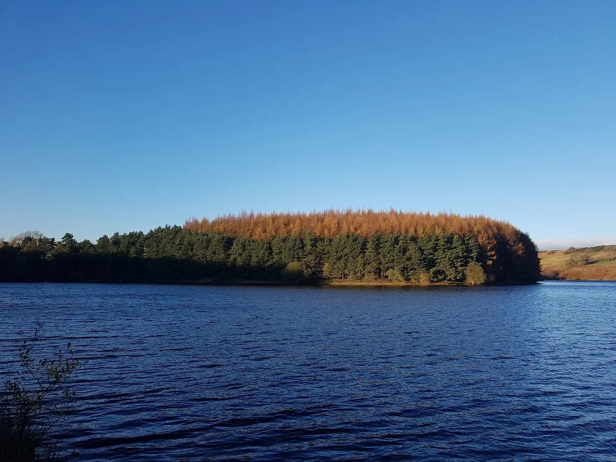
Thruscross Reservoir Loop
Thruscross sits above the rest of the valley and feels it - more open, more exposed, and noticeably quieter than Swinsty and Fewston below. Worth the extra 5 minutes drive.
Mostly on runnable ground, but most runners still walk the steepest climbs.
A 7.9km circuit around Thruscross Reservoir - the highest of the Washburn Valley reservoirs at around 265m. Compact, well-tracked, and quieter than the lower reservoirs.
Thruscross sits above the rest of the valley and feels it - more open, more exposed, and noticeably quieter than Swinsty and Fewston below. Worth the extra 5 minutes drive.
The route
From the Thruscross Reservoir car park (HG3 4BB, accessed from Reservoir Road), the circuit follows the Yorkshire Water track around the reservoir's perimeter. The path runs close to the water on the eastern and southern shores before crossing the embankment dam and returning along the western side.
Thruscross Reservoir sits at around 265m - approximately 100m higher than Fewston and Swinsty below - and was completed in 1966, the most recent of the four Washburn reservoirs. The dam is an earth-filled structure, one of the last built in England using this method. The drowned village of West End lies beneath the water; in prolonged dry summers, the ruins occasionally become visible as water levels drop.
Total distance is 7.9km with 97m of ascent - the most elevation of the single reservoir loops, reflecting the slightly more varied terrain at this height.
Above the valley
The higher elevation gives Thruscross a different feel to the reservoirs below. The surrounding moorland is more open, the tree cover sparser, and the views across the Washburn Valley more extensive. In winter and early spring the site can be exposed - it catches wind from the northwest that doesn't reach Swinsty and Fewston.
The reservoir is quiet. Fewer visitors make the drive up from the valley bottom, which means the circuit is almost always uncrowded regardless of season. Early morning in spring and summer gives you the best chance of seeing the moorland birds that use the surrounding ground.
Connecting routes
Thruscross sits at the top of a logical progression: Swinsty (6.3km) → Fewston and Swinsty (10.3km) → Thruscross from Blubberhouses (13.5km) → all three reservoirs from Blubberhouses (23.7km). This route is the isolated upper circuit; the connecting routes approach from below and link the reservoirs in sequence.
More exposed than the lower reservoirs - stronger winds and reduced shelter on the western bank. Height barrier at car park (2.1m).
Leave No Trace
- Leave nothing but footprints, take nothing but memories.
- Please respect the countryside and all its inhabitants.
- Dogs on leads near livestock, and around ground-nesting birds from March to July.
- Gates as you find them — open or closed, leave it that way for the farmer and the next runner.
- Take it all home — wrappers, peel, tissue, the lot. It doesn't count as biodegradable if you can still see it.
- Stick to the path where the ground either side is wet, planted, or nesting habitat.
Common questions
About the author
Runner reports
Ran this route? Rate it, share conditions, log your time — helps other runners plan their day.
No runner feedback yet
Be the first to run this and report back — ratings appear once a few runners have shared their experience.
No runs logged yet — be the first.



More routes in Nidderdale
 VERY HARD