Skipton Moor and Farnhill Pinnacle
More rewarding than it looks from the map. Skipton Moor has a real open-sky feel, and Farnhill Pinnacle is a genuinely odd and photogenic landmark.
Effort: Good distance, solid climb
Underfoot: Some uneven or off-path ground
E3·T2 — how we grade routesNo photos of this route yet. Sign in to add one
Mostly on runnable ground, but most runners still walk the steepest climbs.
A moorland circuit above Skipton combining the open expanse of Skipton Moor with the distinctive sandstone tower of Farnhill Pinnacle. Good paths throughout with wide views over Airedale.
More rewarding than it looks from the map. Skipton Moor has a real open-sky feel, and Farnhill Pinnacle is a genuinely odd and photogenic landmark.
The route
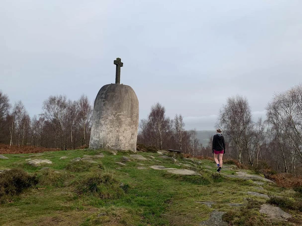
From roadside parking on Shortbank Road above Skipton, the route climbs onto the broad expanse of Skipton Moor before heading east to Farnhill Pinnacle — a 19th century sandstone folly with wide views across Airedale.
Farnhill Pinnacle
Built in the 1800s, the pinnacle is visible from much of the Aire Valley. The views from its base take in Skipton, the Dales, and on clear days the moorland above Ilkley.

Partner · affiliate policy
Boggy sections on the upper moor after rain. Grouse shooting August to December — check for closures.
Summits on this route
Safety on this route
- No signal? Text 999 — pre-register first: text register to 999
- Tell someone your route and expected return time before you head out
Leave No Trace
- Leave nothing but footprints, take nothing but memories.
- Please respect the countryside and all its inhabitants.
- Dogs on leads near livestock, and around ground-nesting birds from March to July.
- Gates as you find them — open or closed, leave it that way for the farmer and the next runner.
- Take it all home — wrappers, peel, tissue, the lot. It doesn't count as biodegradable if you can still see it.
- Stick to the path where the ground either side is wet, planted, or nesting habitat.
Common questions
- Most runners complete Skipton Moor and Farnhill Pinnacle in 2 hours 20 minutes to 3 hours 5 minutes, depending on pace and conditions.
Run by us· last checked June 2026
Jason Millward has run this route and written it up from the ground. How we check routes
About the author
Runner reports
(1)Ran this route? Rate it, share conditions, log your time — helps other runners plan their day.
1 report in the last 12 months · latest 26 days ago
1 runner report so far
4 more reports and we'll show the ratings here. Ran it? Add yours below.
A run of 2 halves. First half is good trails on the moors with a fair bit of climbing. It's a long drag up to Skipton Moor and some parts are quite steep. The descent down to Bradley is fast and easy so you can get your foot down. Farnhill Pinnacle is looking magnificent now it's been repainted and whilst only a short section, the terrain on Farnhill Moor it is good fun. You can always stop for a coffee and cake at Crag and Coffee which is just off the route as you drop onto the dirt road off the moor. It's a good old slog back to Skipton along the canal so save your legs for that. One of my favourite routes from Skipton. Has something for everyone



Start from a town: Skipton 0.3 km · Grassington 12 km · Ilkley 13.2 km
 HARD
HARD EASY
EASY MODERATE
 MODERATE
 HARD
HARD MODERATE
Races on this ground
All Yorkshire Dales races →Races starting within 20 km of the Skipton Moor and Farnhill Pinnacle start, nearest first. If you are entered for one, this route is the rehearsal.
10
Apr
2027

Skipton Skedaddle
Skipton, North Yorkshire · Punk Panther · 1 miles away
Out of the market town and into the Dales — Malham Tarn, Gordale Scar and Pen-y-ghent on the long one.
HARD TO VERY HARD
Entries open
7
Aug
2027
provisional
Dales Dazzler
Skipton, North Yorkshire · Punk Panther · 1 miles away
Skipton to the Pennine Way, Malham Tarn and back down the Dales Way. Fifty miles if you want it.
HARD TO EXPERT
Not open yet
6
Feb
2027

Skipton Sweetie Skedaddle
Craven Leisure Centre, Gargrave Road, Skipton · It's Grim Up North Running · 1 miles away
The Leeds & Liverpool towpath out of Skipton, flat and fast, 10k to ultra with a six-and-a-half-hour cut-off and sweets, chocolate and cake at the finish. Road shoes suggested.
Entries open
£29–£43
5
Aug
2027
Skipton Rock Up n' Run
Craven Leisure Centre, Gargrave Road, Skipton · It's Grim Up North Running · 1 miles away
A midweek summer evening 5k or 10k on the Leeds & Liverpool towpath from Craven Leisure Centre in Skipton. Register from six, pay on the night, jumble medal and hot food after.
Entries open
£17–£29