Ilkley to Rombalds Moor Loop
Over 400 prehistoric cup-and-ring carved stones are scattered across this moor, and you'll pass several without trying - a working archaeological landscape disguised as an ordinary heather moor.
Almost entirely runnable — minimal steep sections.
Over 400 prehistoric cup-and-ring carved stones are scattered across this moor, and you'll pass several without trying - a working archaeological landscape disguised as an ordinary heather moor.
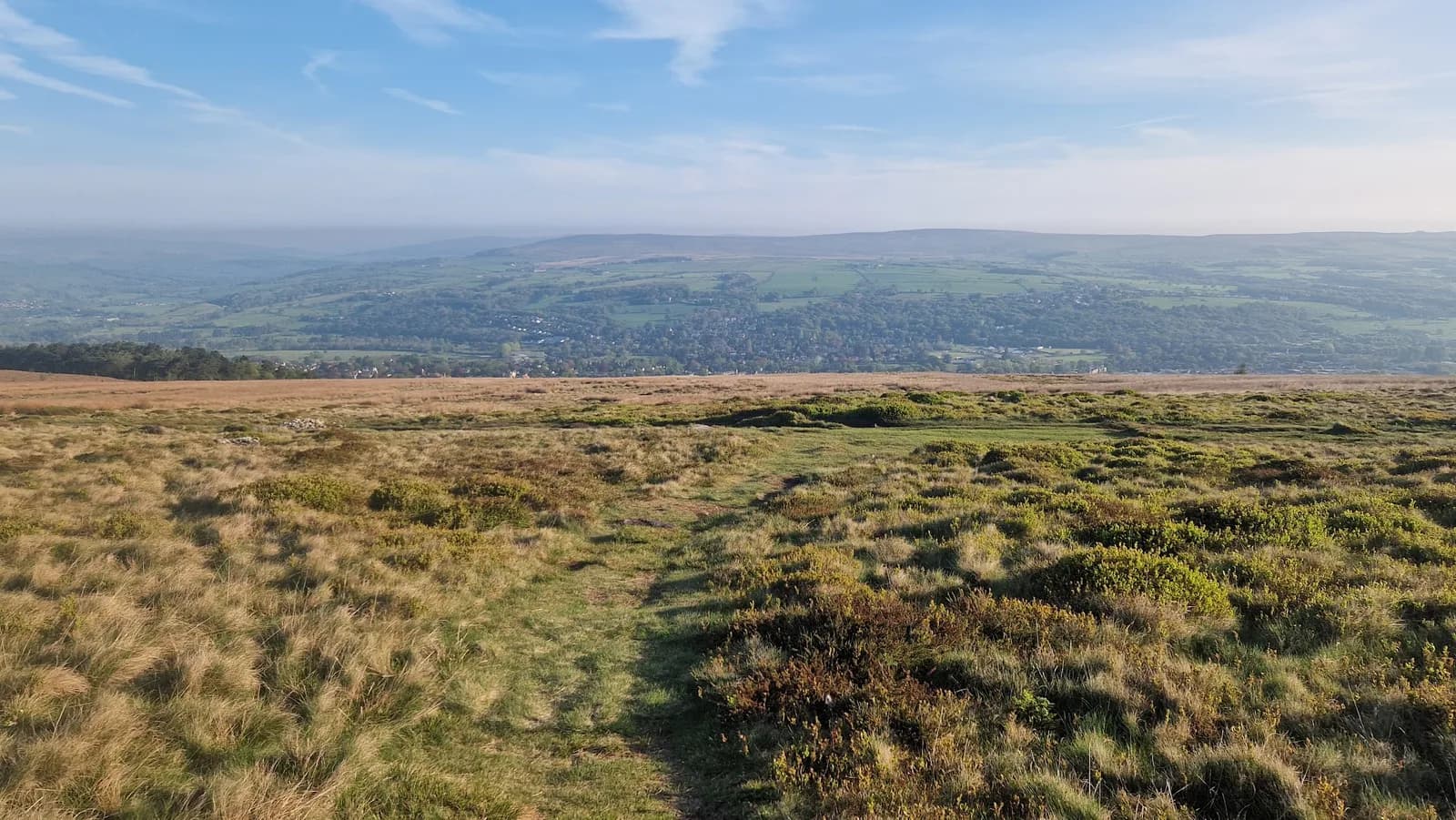
A loop from Ilkley up onto Rombalds Moor, taking in the Cow and Calf rocks and the open heather moor above Ilkley, Burley and Hawksworth. 15.6km, 136m of ascent, on tracks across one of the most archaeologically rich moors in the country.
The route
This loop leaves Ilkley and climbs straight onto Rombalds Moor, the high heather plateau shared between Ilkley, Burley, Hawksworth, Bingley and Morton moors. At 15.6km with 373m of ascent, the climbing is gentle and spread out rather than concentrated in one pull, which makes this a good moor route for building moorland confidence without a brutal first kilometre.
The moor
Rombalds Moor sits in the South Pennines rather than a national park or AONB, and parts of it now fall within the Bradford Pennine Gateway National Nature Reserve. What sets it apart from other moors nearby is the archaeology: over 400 cup-and-ring carved stones are scattered across the heather, prehistoric markings whose purpose still isn't fully understood. You'll pass the Cow and Calf rocks early on - a popular spot with climbers and a good landmark if visibility drops - and the going underfoot moves between solid path and softer, peatier ground depending on the line you pick.
Getting there
Ilkley has an hourly direct train to and from Leeds, taking around 27 to 29 minutes, which makes this an easy one to reach without a car. The free car park on Hangingstone Road has toilets and a small cafe on site, and also allows overnight motorhome parking if you're making a longer trip of it.
Why it works
This route earns its place by packing genuine moorland character - heather, exposed rock, long sightlines over Wharfedale - into a loop you can run from a train station. Spring brings ground-nesting birds to the moor, so keep dogs under control and stick to the main tracks during that period, but otherwise this is one of the more accessible serious moors in Yorkshire, accessible being the operative word given the rail link and the on-site facilities at the start.
Heather moorland can disorientate quickly in mist or low cloud, even though paths are generally well used. Ground-nesting birds are present in spring, so keep dogs on the main tracks and under close control between March and July.
Summits on this route



Safety on this route
- No signal? Text 999 — pre-register first: text register to 999
- Tell someone your route and expected return time before you head out
Leave No Trace
- Leave nothing but footprints, take nothing but memories.
- Please respect the countryside and all its inhabitants.
- Dogs on leads near livestock, and around ground-nesting birds from March to July.
- Gates as you find them — open or closed, leave it that way for the farmer and the next runner.
- Take it all home — wrappers, peel, tissue, the lot. It doesn't count as biodegradable if you can still see it.
- Stick to the path where the ground either side is wet, planted, or nesting habitat.
Common questions
About the author
Runner reports
Ran this route? Log your time, rate it, share conditions — helps other runners plan their day.
No runs logged yet — be the first.
More routes in South Pennines
 HARD
HARD