Watergrove Reservoir and Norden Moor
Long moor miles above Rochdale without the crowds of the Dales. Watergrove Reservoir sits at the heart of a circuit that earns its distance across proper South Pennines terrain.
Effort: Good distance, solid climb
Underfoot: Some uneven or off-path ground
E3·T2 — how we grade routesAlmost entirely runnable — minimal steep sections.
Long moor miles above Rochdale without the crowds of the Dales. Watergrove Reservoir sits at the heart of a circuit that earns its distance across proper South Pennines terrain.
A 19.5km moorland circuit above Rochdale taking in Watergrove Reservoir and the open ground of the South Pennines, with connections to the Pennine Bridleway.
The route
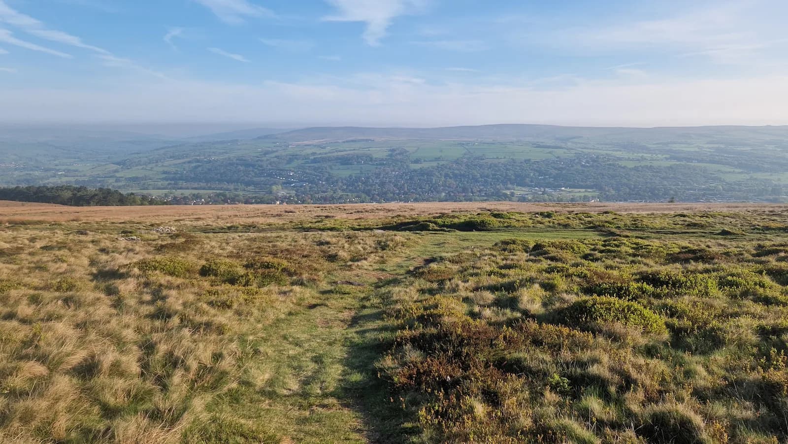
Starting from the Norden area north of Rochdale, the route climbs onto the moorland above the town, heading east toward Watergrove Reservoir - one of the higher reservoirs in the Rochdale uplands, managed by United Utilities and sitting at around 280m.
The circuit follows bridleway and moorland path around the reservoir before pushing out onto the open ground of the surrounding moor. The South Pennines here has a distinct character: broad moorland ridges, dark gritstone edges, and the industrial valleys of East Lancashire visible far below. Connections to the Pennine Bridleway mean the route can be linked to longer inter-valley routes.
The return descends back through moorland tracks to the starting area, covering 19.5km with 133m of measured ascent. Note that the actual elevation change across this terrain may vary - the GPX data gives a conservative reading, and the moor has more undulation than the headline figure suggests.
South Pennines running
The South Pennines AONB stretches from the edges of Calderdale south through Rossendale - a corner of England that most runners drive through on the M62 without a second thought. The terrain rewards closer inspection. The moorland above Rochdale is genuine high ground, the paths are solid, and the combination of reservoir circuit and open moor creates the kind of route that builds fitness quietly.
Watergrove Reservoir has Pennine Bridleway access and hosts a weekly parkrun (5km, Saturday mornings) - useful if you want to do a recce before committing to the longer circuit.
Getting there
Watergrove is accessible from Wardle village: from Rochdale follow the A58 toward Halifax, turn left at Birch Road, continue through Wardle village to reach the reservoir. Parking is free in the car park on Ramsden Road. The site has no cafe but there are pubs in Wardle village. Public transport is limited - car is the practical option.
The route shares some sections with mountain bikers and other off-road users. Flagstone paths and cobbled bridleways appear on the moorland sections - classic South Pennines underfoot.
Some navigation required on moorland sections in poor visibility. Flagstone and cobbled bridleways can be slippery when wet. Remote sections with limited shelter.



Safety on this route
- No signal? Text 999 — pre-register first: text register to 999
- Tell someone your route and expected return time before you head out
Leave No Trace
- Leave nothing but footprints, take nothing but memories.
- Please respect the countryside and all its inhabitants.
- Dogs on leads near livestock, and around ground-nesting birds from March to July.
- Gates as you find them — open or closed, leave it that way for the farmer and the next runner.
- Take it all home — wrappers, peel, tissue, the lot. It doesn't count as biodegradable if you can still see it.
- Stick to the path where the ground either side is wet, planted, or nesting habitat.
Common questions
About the author
Runner reports
Ran this route? Log your time, rate it, share conditions — helps other runners plan their day.
No runs logged yet — be the first.
More routes in South Pennines
 HARD
HARD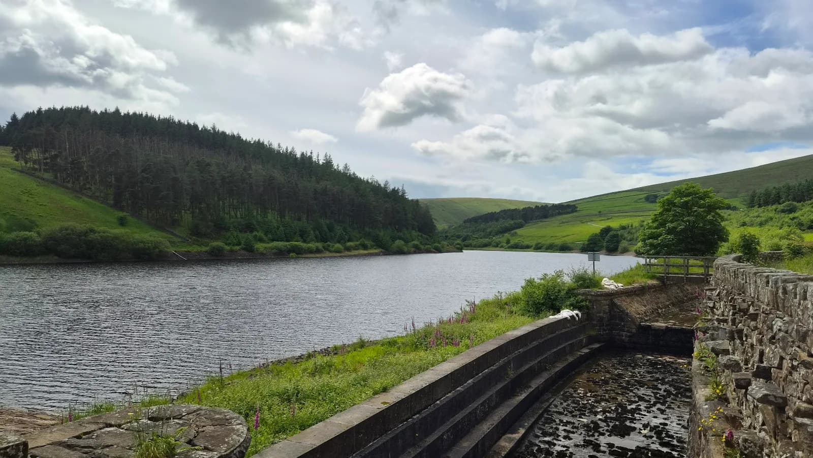 HARD
HARD