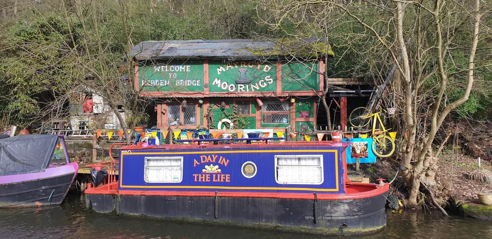
Stoodley Pike from Hebden Bridge
You climb from a canal in the valley floor to a 37m stone monument on the moor edge, and the view back over Calderdale from the base of the Pike is worth every metre of the climb.
Effort: Moderate distance, manageable climb
Underfoot: Open fell or rough terrain
E2·T3 — how we grade routesNo photos of this route yet. Sign in to add one
A 12.5km loop from Hebden Bridge up to the Stoodley Pike monument and back, with 300m of climbing. Canal towpath at the bottom, a stiff pull onto the moor, and a big Pennine landmark at the top.
You climb from a canal in the valley floor to a 37m stone monument on the moor edge, and the view back over Calderdale from the base of the Pike is worth every metre of the climb.
The route
This is the classic Calderdale outing: a 12.5km loop from Hebden Bridge to Stoodley Pike and back, with 300m of climbing packed mostly into one honest ascent. You start low, following the Rochdale Canal towpath out of town for a fast, flat warm-up, then turn uphill and climb steadily through fields and onto the open moor. The monument dominates the skyline for most of the way up, so you always know where you are heading.
The monument
Stoodley Pike is hard to miss: a 37m gritstone tower on the moor edge at around 400m, first built to mark the end of the Napoleonic wars and rebuilt in 1856 after the Crimean War. You can climb the internal staircase to the viewing platform if the door is open, and the view over the Calder valley and the South Pennine moors is the reward for the climb. The route joins a short section of the Pennine Way along the top before dropping back toward the valley.
The descent and return
The way down is rougher than the towpath: moorland paths and field tracks that can be greasy and slow when wet, so keep something in reserve for tired legs. Once you are back at the canal it is an easy run back into Hebden Bridge and its many cafes.
Why it works
It is a compact route with a genuine summit feel and a landmark payoff, reachable entirely by train. The mix of flat towpath and one real climb makes it a good hill session or a satisfying half-day when you do not have time for the bigger moors.
Good to know
The towpath start lets you warm up properly before the climb bites, and the single big ascent makes this an ideal route for practising a strong, steady uphill effort. Save something for the descent, which is where tired legs and greasy ground catch people out, and pack a windproof: the top can feel a season colder than the sheltered valley you started in.

Partner · affiliate policy
The moor above Stoodley Pike is exposed and boggy, and the top catches wind and low cloud, so carry a layer even on mild days. The descent paths get slick after rain, and the moorland sections can be soft underfoot year round.
Safety on this route
- No signal? Text 999 — pre-register first: text register to 999
- Tell someone your route and expected return time before you head out
Leave No Trace
- Leave nothing but footprints, take nothing but memories.
- Please respect the countryside and all its inhabitants.
- Dogs on leads near livestock, and around ground-nesting birds from March to July.
- Gates as you find them — open or closed, leave it that way for the farmer and the next runner.
- Take it all home — wrappers, peel, tissue, the lot. It doesn't count as biodegradable if you can still see it.
- Stick to the path where the ground either side is wet, planted, or nesting habitat.
Common questions
- Most runners complete Stoodley Pike from Hebden Bridge in 1 hour 35 minutes to 2 hours 10 minutes, depending on pace and conditions.
Run by us· last checked July 2026
Jason Millward has run this route and written it up from the ground. How we check routes
About the author
Runner reports
Nobody's logged a run here yet. If you get out on it, a few lines about how it went helps the next person plan their day.



Routes nearby
 VERY HARD
 VERY HARD
 MODERATE
 VERY HARD
 VERY HARD
Races on this ground
All South Pennines races →Races starting within 20 km of the Stoodley Pike from Hebden Bridge start, nearest first. If you are entered for one, this route is the rehearsal.
17
Jul
2027
She Strides Trail Metric Marathon
The Excited Goat, Crown Street, Hebden Bridge · She Strides Events · 0 miles away
26 km flagged out-and-back from Hebden Bridge past Stoodley Pike
Not open yet
£35
1
May
2027
Calderdale Way Ultra
Heptonstall Bowling Club, Heptonstall, Hebden Bridge · She Strides Events · 1 miles away
30 or 50 miles on the Calderdale Way, starting and finishing in Heptonstall
EXPERT
Not open yet
£55–£65
17
Oct
2026
Rip 'n' Run XL
Wadsworth Community Centre, Old Town, Hebden Bridge · She Strides Events · 1 miles away
40-mile moor-and-lane loop above Hebden Bridge, or two laps for 80 miles
EXPERT
Not open yet
£60–£110
19
Jun
2027
Two Roses Ultra
Wadsworth Community Centre, Billy Lane, Old Town, Hebden Bridge · She Strides Events · 1 miles away
Two 50 km loops, Lancashire and Yorkshire, or both for 100 km from Hebden Bridge
Not open yet
£55–£100
31
Jul
2027
She Strides Ultra
Wadsworth Community Centre, Billy Lane, Old Town, Hebden Bridge · She Strides Events · 1 miles away
Women-only 50 km marked loop over the moors from Hebden Bridge to Haworth
VERY HARD
Not open yet
£50–£65
12
Dec
2026

Moors The Merrier 21
Mytholmroyd Community Centre · Cragg Runner · 1 miles away
Twenty-one miles round the moors above Hebden Bridge in December, in a Santa hat, with a present for the bran tub.
Entries open