Salt and Pepper Pots from Skipton
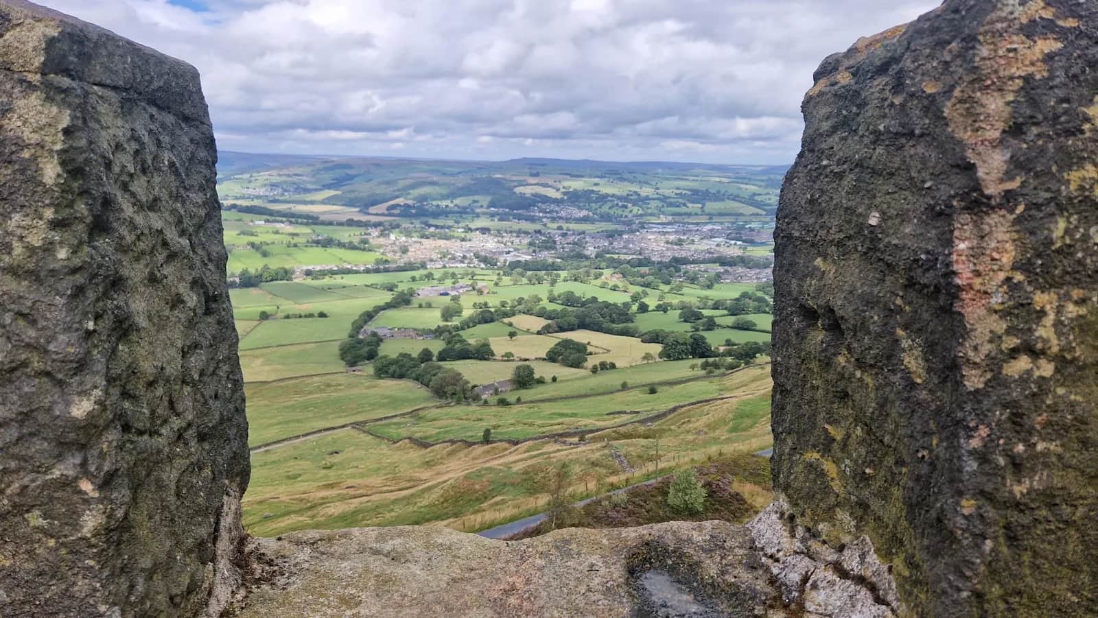
A point-to-point feel on a loop, linking a bustling market town to a wild gritstone edge crowned by two eccentric Victorian towers with huge views to Pendle.
No photos of this route yet. Sign in to add one
Mostly on runnable ground, but most runners still walk the steepest climbs.
A 26.3km loop from Skipton south to the gritstone edge of Earl Crag and its two landmark follies, Lund's Tower and Wainman's Pinnacle, known as the Salt and Pepper Pots.
A point-to-point feel on a loop, linking a bustling market town to a wild gritstone edge crowned by two eccentric Victorian towers with huge views to Pendle.
The route
This 26.3km loop heads out of Skipton and into the rolling farmland and moor edge of the South Pennines, building gradually toward the gritstone scarp of Earl Crag. The early miles cross a patchwork of field paths, walled lanes and tracks that demand attention to navigation, before the ground opens up and climbs onto the breezy ridge above Cowling and Sutton-in-Craven.
The follies
The highlight is Earl Crag itself, where two listed monuments stand against the sky. Lund's Tower, built in 1887, and Wainman's Pinnacle, an obelisk raised as a Napoleonic memorial, are known locally as the Salt and Pepper Pots for their resemblance to the table set. From the edge at around 370m the view sweeps across the Aire gap to the long whaleback of Pendle Hill. The route then loops back north on tracks and paths toward Skipton.
Why it works
This is a route with character rather than big summits, trading mountain height for quirky landmarks, gritstone atmosphere and genuine moorland solitude close to a major town. The mix of field paths and open moor keeps the navigation interesting, and the towers give the day a clear focal point. It works well as a long training run with easy logistics, since Skipton has parking, a railway station and plenty of cafes. Watch the field-path navigation in the lower sections and respect grouse moor access on the high ground.
Getting there
Skipton is easy to reach, with a station on the Airedale line and several car parks near the centre. That makes the logistics simple for a route that otherwise feels surprisingly remote once you climb to Earl Crag. The two towers are visible for miles and make a satisfying turning point, marking the moment you swing back north across the fields toward town and a well-earned cafe stop.

Partner · affiliate policy
Complex field-path navigation in the lower sections is easy to get wrong. The Earl Crag edge is exposed to weather, and the high moorland is managed for grouse with shooting from August to December.
Safety on this route
- No signal? Text 999 — pre-register first: text register to 999
- Tell someone your route and expected return time before you head out
Leave No Trace
- Leave nothing but footprints, take nothing but memories.
- Please respect the countryside and all its inhabitants.
- Dogs on leads near livestock, and around ground-nesting birds from March to July.
- Gates as you find them — open or closed, leave it that way for the farmer and the next runner.
- Take it all home — wrappers, peel, tissue, the lot. It doesn't count as biodegradable if you can still see it.
- Stick to the path where the ground either side is wet, planted, or nesting habitat.
Common questions
- Most runners complete Salt and Pepper Pots from Skipton in 3 hours 35 minutes to 4 hours 50 minutes, depending on pace and conditions.
Run by us· last checked July 2026
Jason Millward has run this route and written it up from the ground. How we check routes
About the author
Runner reports
Nobody's logged a run here yet. If you get out on it, a few lines about how it went helps the next person plan their day.



Routes nearby
Start from a town: Skipton 1.3 km · Ilkley 12.1 km · Grassington 12.4 km
 EXPERT
 HARD
HARD EXPERT
 EASY
EASY MODERATE
 MODERATE
Races on this ground
All South Pennines races →Races starting within 20 km of the Salt and Pepper Pots from Skipton start, nearest first. If you are entered for one, this route is the rehearsal.
10
Apr
2027

Skipton Skedaddle
Skipton, North Yorkshire · Punk Panther · 1 miles away
Out of the market town and into the Dales — Malham Tarn, Gordale Scar and Pen-y-ghent on the long one.
HARD TO VERY HARD
Entries open
7
Aug
2027
provisional
Dales Dazzler
Skipton, North Yorkshire · Punk Panther · 1 miles away
Skipton to the Pennine Way, Malham Tarn and back down the Dales Way. Fifty miles if you want it.
HARD TO EXPERT
Not open yet
6
Feb
2027

Skipton Sweetie Skedaddle
Craven Leisure Centre, Gargrave Road, Skipton · It's Grim Up North Running · 2 miles away
The Leeds & Liverpool towpath out of Skipton, flat and fast, 10k to ultra with a six-and-a-half-hour cut-off and sweets, chocolate and cake at the finish. Road shoes suggested.
Entries open
£29–£43
5
Aug
2027
Skipton Rock Up n' Run
Craven Leisure Centre, Gargrave Road, Skipton · It's Grim Up North Running · 2 miles away
A midweek summer evening 5k or 10k on the Leeds & Liverpool towpath from Craven Leisure Centre in Skipton. Register from six, pay on the night, jumble medal and hot food after.
Entries open
£17–£29