Ingleborough and Little Ingleborough from Ingleton
The quieter western approach to Ingleborough, building over Little Ingleborough to the iconic plateau summit at 724m before the long descent back to Ingleton.
The quieter western approach to Ingleborough, building over Little Ingleborough to the iconic plateau summit at 724m before the long descent back to Ingleton.
A 14.8km out-and-back-style loop from Ingleton climbing over Little Ingleborough to the flat-topped summit of Ingleborough, one of the Yorkshire Three Peaks.
The route
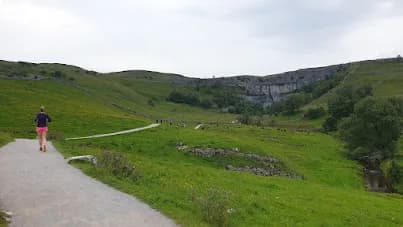
Most runners tackle Ingleborough from Horton or Ribblehead, which makes this Ingleton approach a refreshingly quiet alternative. The 14.8km route leaves the village and climbs steadily through farmland and onto open fell, gaining height toward the broad shoulder of Little Ingleborough. The going is a mix of good track and rougher moorland, with the summit block of Ingleborough drawing the eye ahead.
The summit
Little Ingleborough is a worthy top in its own right, a flattening of the ridge that frames the final pull. From here a short, steeper climb gains the famous summit plateau of Ingleborough at 724m, a broad flat top ringed by the remains of an Iron Age hillfort. On a clear day the view takes in Whernside, Pen-y-ghent, Morecambe Bay and the Lakeland fells. The summit plateau is notorious in cloud, so take a bearing before you leave it for the descent back toward Ingleton.
Why it works
This route gives you a true mountain summit without the crowds of the main Three Peaks paths, and at under 15km it is achievable for runners stepping up to bigger fell days. The climbing is steady rather than brutal, and the descent gives long, flowing running on the return. Treat the summit plateau with respect, carry a map and compass, and pick conditions that let you enjoy the view rather than fight the weather.
Getting there
Ingleton sits at the western edge of the Three Peaks country and is reached by the Craven Connection bus or by car, with parking at the community centre. The village is best known for its waterfalls trail, but this route heads the other way, onto the open fell. Combine it with the falls afterward, or refuel in one of Ingleton's cafes, long popular with climbers and cavers heading for the local crags and potholes.
The flat summit plateau of Ingleborough is genuinely disorienting in cloud, where many lose the path. Expect boggy approaches, a steep final climb, and full exposure to weather on top.
Summits on this route


Safety on this route
- No signal? Text 999 — pre-register first: text register to 999
- Tell someone your route and expected return time before you head out
Common questions
More routes in Yorkshire Dales
 HARD
HARD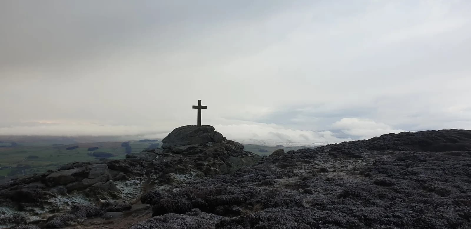 HARD
HARD MODERATE