Helvellyn via Swirral Edge and Striding Edge from Thirlmere
You get the two most famous ridges on the fell, Swirral and Striding Edge, on a route that still starts and finishes on the quiet Thirlmere side.
Effort: Shorter distance, serious climb
Underfoot: Technical, navigation required
E4·T4 — how we grade routesNo photos of this route yet. Sign in to add one
A real mix of running and walking — expect significant climbing.
An 11.3km loop from Thirlmere that crosses to the east side of Helvellyn to take in both Swirral Edge and Striding Edge, the two classic aretes, with 998m of climb.
You get the two most famous ridges on the fell, Swirral and Striding Edge, on a route that still starts and finishes on the quiet Thirlmere side.
The route
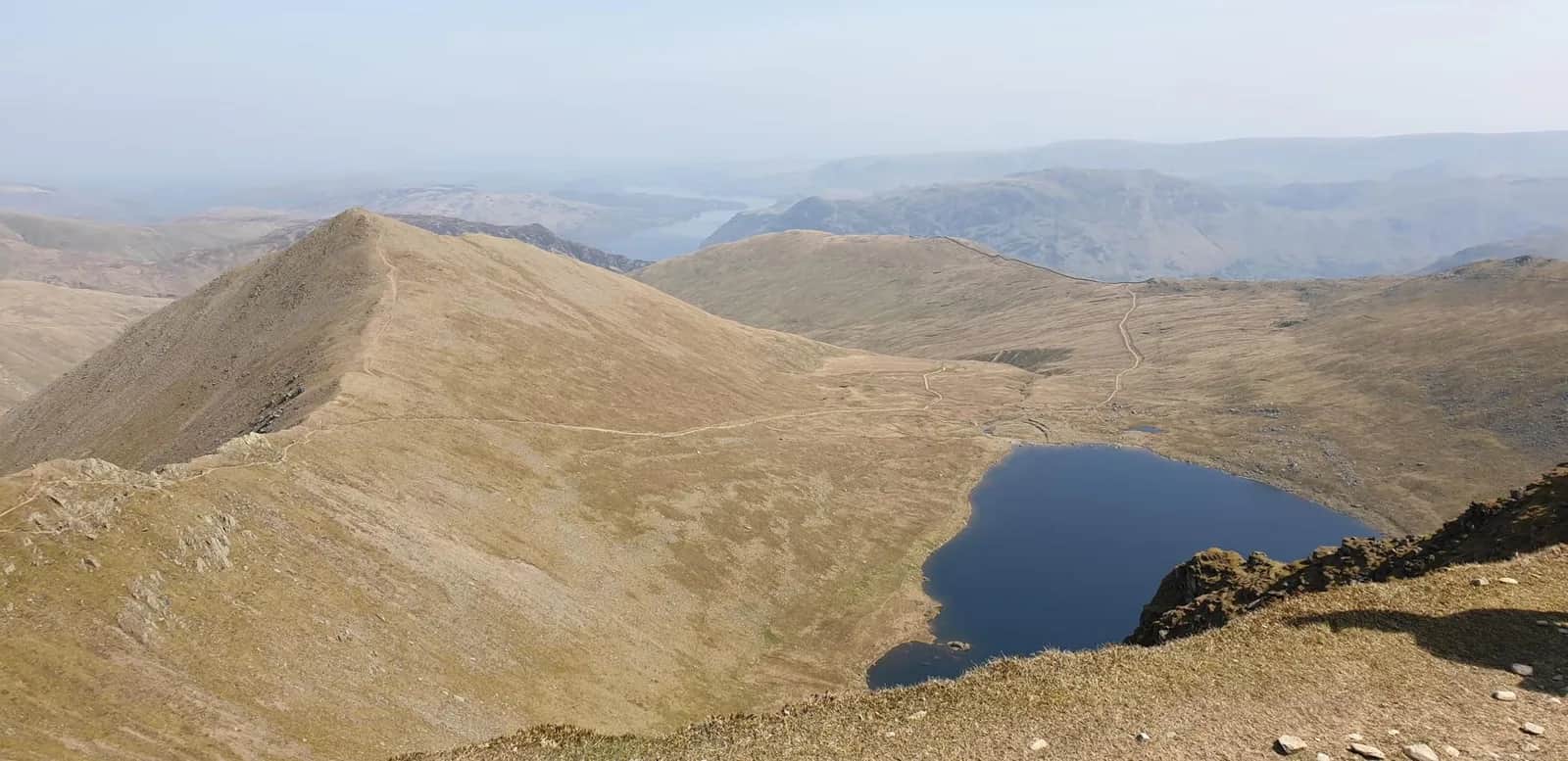
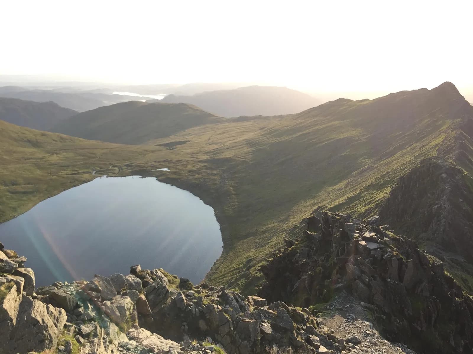
This loop borrows the best of both worlds. You climb out of Swirls on the made path toward Helvellyn Lower Man (925m), then instead of staying on the plateau you drop east down Swirral Edge to the saddle below Catstye Cam, with Red Tarn cupped beneath you. From there you pick up Striding Edge and traverse the arete back up to the 950m summit, before returning west to Thirlmere. It packs both grade 1 scrambles into 11.3km and 998m of ascent.
The edges
Swirral Edge and Striding Edge are the reason Helvellyn is the most climbed high fell in England. Both are rocky, exposed grade 1 scrambles where a slip would be serious, and Striding Edge in particular claims lives most years in ice or high wind. There is a worn bypass path below the crest of Striding Edge if you want to lower the commitment, but the true line along the top is hands-on and demands a steady head. Move with care where the rock is polished, and do not take the edges on in a strong cross-wind.
Why it works
Approaching the aretes from the Thirlmere side means you do the scrambling in the middle of the run rather than as a there-and-back from Glenridding, and you finish with fast grass back down to the car. Helvellyn, a Wainwright of the Eastern Fells, more than earns its place here, and Catstye Cam (890m) sits right below the Swirral saddle if you want to add it. The arc back to Swirls along the made path is fast, grassy descending once the rock is behind you. Save energy for the edges; this is a hard outing for the distance because the technical ground, not the 998m of climb, sets the pace, and a queue on Striding Edge in summer can cost more time than the ascent. Pick a dry, calm day, carry a map for the plateau, and the round delivers everything Helvellyn is famous for in a single tidy loop.

Partner · affiliate policy
Striding Edge and Swirral Edge are exposed grade 1 scrambles where a fall would be fatal, treacherous when wet, iced or windy. The drop to Red Tarn is sheer; in winter both edges need axe, crampons and experience.
Summits on this route
Safety on this route
- No signal? Text 999 — pre-register first: text register to 999
- Tell someone your route and expected return time before you head out
Leave No Trace
- Leave nothing but footprints, take nothing but memories.
- Please respect the countryside and all its inhabitants.
- Dogs on leads near livestock, and around ground-nesting birds from March to July.
- Gates as you find them — open or closed, leave it that way for the farmer and the next runner.
- Take it all home — wrappers, peel, tissue, the lot. It doesn't count as biodegradable if you can still see it.
- Stick to the path where the ground either side is wet, planted, or nesting habitat.
Common questions
- Most runners complete Helvellyn via Swirral Edge and Striding Edge from Thirlmere in 2 hours 5 minutes to 2 hours 50 minutes, depending on pace and conditions.
Run by us· last checked July 2026
Jason Millward has run this route and written it up from the ground. How we check routes
About the author
Runner reports
Nobody's logged a run here yet. If you get out on it, a few lines about how it went helps the next person plan their day.



Routes nearby
Start from a town: Keswick 8.2 km · Ambleside 14 km
 VERY HARD
 EXPERT
 VERY HARD
 VERY HARD
 EXPERT
 MODERATE
Races on this ground
All Lake District races →Races starting within 20 km of the Helvellyn via Swirral Edge and Striding Edge from Thirlmere start, nearest first. If you are entered for one, this route is the rehearsal.
25
Sept
2027

6 Valleys Ultra
Borrowdale, Cumbria · 13 Valleys Ultra · 4 miles away
New for 2027: Borrowdale to Keswick, waymarked, between the 5 and the 7.
Entries open
16
Jul
2027
provisional

Swirral Grind 850
Patterdale, Cumbria · Lake District Sky Trails · 4 miles away
Six kilometres, 850 metres up Swirral Edge.
Not open yet
17
Jul
2027
Helvellyn Sky Ultra
Patterdale, Cumbria · Lake District Sky Trails · 4 miles away
Fifty-seven kilometres over Helvellyn's ridges, 3,700 metres of ascent.
Entries open
17
Jul
2027
Pinnacle Ridge Extreme
Patterdale, Cumbria · Lake District Sky Trails · 4 miles away
Twenty-eight kilometres with a graded scramble on the route. Entry is vetted.
Entries open