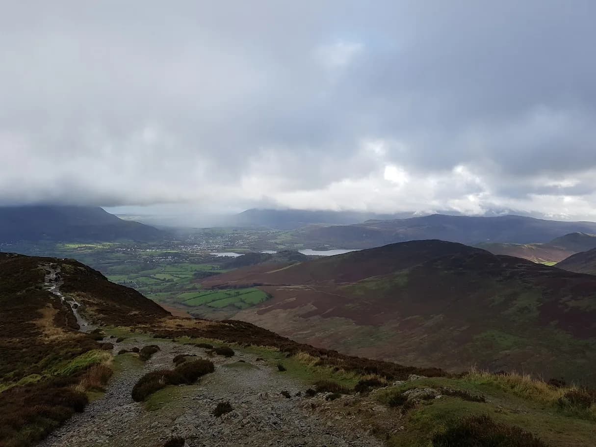
Best Trail Runs From Keswick: 7 Northern Lakes Routes
Seven trail runs from Keswick, 8.3km to 48.2km, all with free GPX: from Latrigg and a lap of Derwentwater to Coledale and Abraham's Tea Round.
Seven of our routes start in Keswick or just outside it, from an 8.3 km out-and-back up Latrigg to the 48.2 km Abraham's Tea Round, with 21 m to 3,378 m of climb. Five start in the town itself. The Coledale Horseshoe starts in Braithwaite, 4 km away, and Skiddaw and Blencathra starts at the Gale Road car park above town. Every route has a free GPX file, with no account and no email needed, and every grade is honest, so a Very Hard here means the same as a Very Hard anywhere else on the site.
Why Keswick works as a base
The fells start at the edge of town. Latrigg rises directly behind Keswick, Skiddaw sits behind that, Derwentwater is a few minutes' run from the centre, and Borrowdale opens up to the south. You can run a flat lake lap, a small summit before breakfast and a full mountain day without moving the car, because five of these seven routes start in Keswick itself.
Keswick has no railway station, but the buses are good. The Stagecoach X4 and X5 run from Penrith railway station, the 555 comes in from Windermere and Kendal, and the open-top 77A and 78 reach the surrounding valleys. The seasonal 78 Borrowdale Bus follows the eastern shore of Derwentwater, which makes it handy for cutting a lake route short. The Keswick Launch ferry crosses to the Hawes End landing on the western shore.
For parking, Lakeside long stay is the main pay and display car park, with around 250 spaces and toilets on site. It sits right by the lake and fills early on summer weekends. Bell Close is the other central option. The free Gale Road car park above town has around 15 spaces and fills early, and it can be icy in winter. Afterwards there's a full choice of cafes and pubs in town, including Abraham's Cafe on the top floor of George Fisher, the start and finish of the Tea Round.
The routes at a glance
| Route | Distance | Ascent | Grade | Terrain | Type | Best for |
|---|---|---|---|---|---|---|
| Latrigg from Keswick | 8.3 km | 288 m | Moderate (E2·T2) | Fell, path | Out-and-back | A summit before breakfast |
| Derwentwater Round from Keswick | 14.6 km | 21 m | Moderate (E2·T1) | Path, woodland | Loop | Flat, easy distance |
| Coledale Horseshoe | 14.8 km | 1,199 m | Very Hard (E4·T3) | Fell, path | Loop | The classic ridge round |
| Catbells from Keswick | 16.8 km | 431 m | Hard (E3·T2) | Mixed, fell | Loop | Catbells without the car |
| Skiddaw and Blencathra via Lonscale Fell | 23.2 km | 1,412 m | Very Hard (E4·T4) | Fell, moorland | Loop | The big Northern Fells day |
| Walla Crag, Castle Crag and Derwentwater from Keswick | 26.2 km | 719 m | Hard (E3·T2) | Woodland, path | Loop | A long, low day into Borrowdale |
| Abraham's Tea Round | 48.2 km | 3,378 m | Expert (E5·T4) | Fell | Loop | Keswick's rite of passage |
Grades combine effort (E) and terrain (T). The grading explainer covers how we work them out.
Easy and moderate runs from the town
Latrigg from Keswick
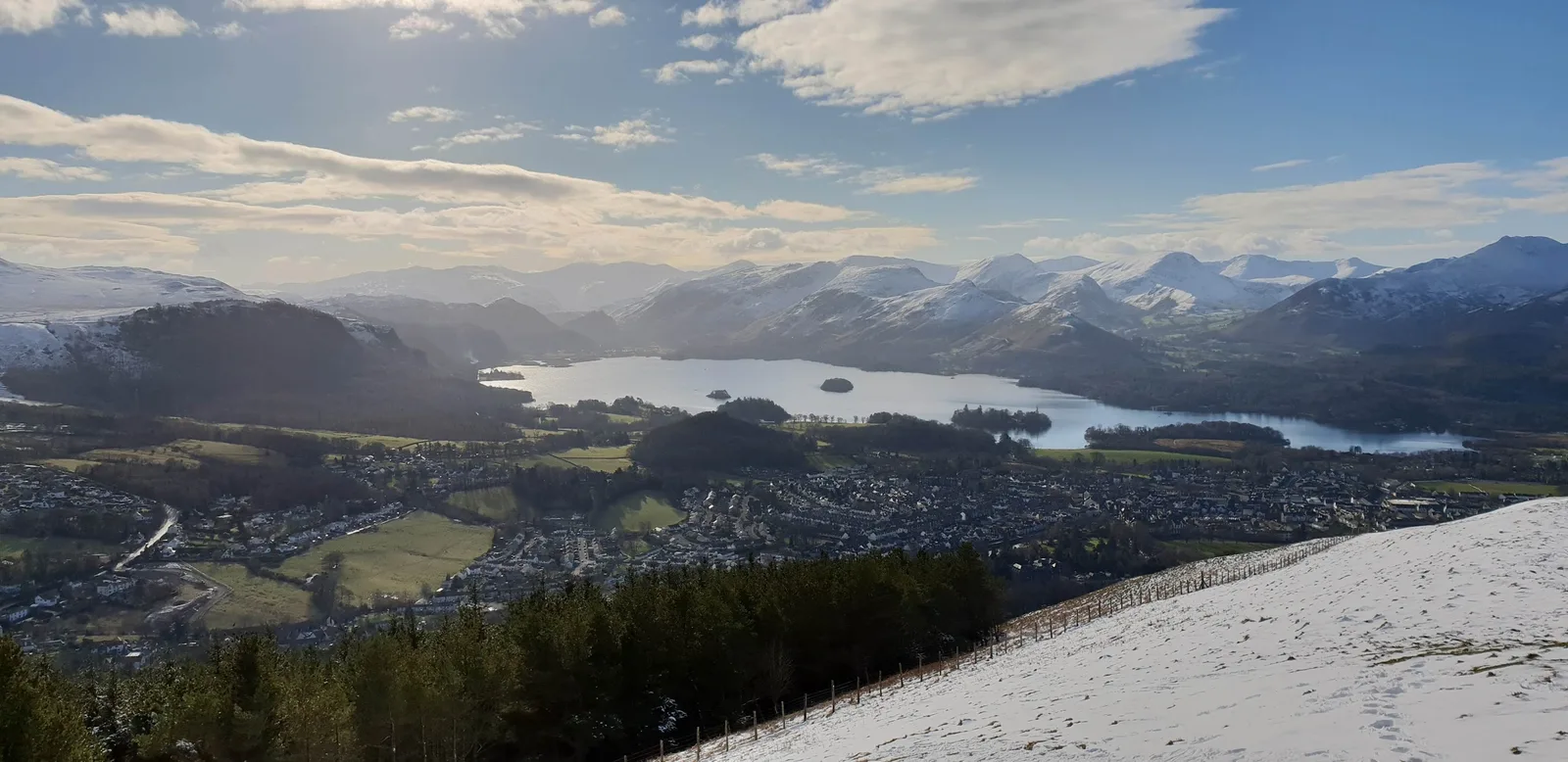
Latrigg from Keswick is an 8.3 km out-and-back with 288 m of climb, graded Moderate (E2·T2). Most runners take 70 to 95 minutes. Latrigg is the green, rounded fell directly above Keswick, and it gives one of the best low summit views in the Lakes: Derwentwater stretching south into Borrowdale, the town directly below, and Skiddaw rising straight behind you.
From town you cross above the A66 and pick up the well-graded path that zigzags up Latrigg's southern flank. The climb is steady and runnable for most, easing onto a broad grassy summit ridge with a bench near the top. Take care crossing above the A66 near the start. The summit ridge is open and exposed to wind despite its modest height, and the grassy descent is slippery when wet. It's one of the few routes here that lists winter among its best seasons, and with a mud rating of 2 out of 5 it holds up well year-round. The lower slopes also form the opening climb of the Skiddaw Fell Race.
Latrigg from Keswick: route & free GPX →
Derwentwater Round from Keswick
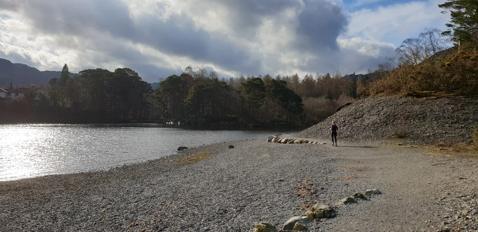
The Derwentwater Round from Keswick is a full 14.6 km lap of the lake with just 21 m of climb, graded Moderate (E2·T1). Expect 95 to 125 minutes. It's the easiest distance run in the northern Lakes and the obvious choice for a recovery day or a first long run.
From Keswick you follow the eastern shore south through Great Wood, beneath Walla Crag, then cross the flatter ground at the head of the lake with views into Borrowdale before coming back along the quieter western shore past Brandelhow. The path is good all the way round, so you can settle into a rhythm. The catch is water: the low-lying ground near the head of the lake floods readily after rain and can be ankle-deep in winter, and tree roots and boardwalk are slippery when wet. The Lingholm Kitchen sits just off the western shore, and the seasonal 78 Borrowdale Bus runs along the eastern side if you want a shorter point-to-point.
Derwentwater Round from Keswick: route & free GPX →
Hard: summits the long way
Catbells from Keswick
Catbells from Keswick is a 16.8 km loop with 431 m of climb, graded Hard (E3·T2) for the distance rather than the ground. It takes 130 to 175 minutes. Rather than driving to Hawes End, you run to Catbells from town along the shore of Derwentwater, climb the 451 m summit, and loop back, so no car is needed.
Most of it is very runnable. The climb onto Catbells is short and direct, with a couple of rocky steps near the top where your hands come in useful. From the summit, Derwentwater is laid out below with Keswick at its head, Skiddaw and Blencathra to the north and the Newlands fells rolling away to the west. Those rocky steps are slippery in the wet, the ridge is exposed to wind, and the lakeshore paths flood in places after prolonged rain. It lists winter among its best seasons, and the Lingholm Kitchen is just off the route on the western shore.
Catbells from Keswick: route & free GPX →
Walla Crag, Castle Crag and Derwentwater from Keswick
Walla Crag, Castle Crag and Derwentwater from Keswick is a 26.2 km loop with 719 m of climb, graded Hard (E3·T2). Most runners take between 3 hours 25 minutes and 4 hours 40 minutes. It's the grand tour of Derwentwater and Borrowdale, taking in two small summits on a long, low day.
You climb through Great Wood to the lip of Walla Crag, with the view straight down onto Derwentwater, then head south into the wooded jaws of Borrowdale to the steep slate top of Castle Crag, and return along the lake. The footing is good on woodland trail, riverside and shoreline path, and the effort comes from the distance rather than steep climbing. The edge of Walla Crag is an abrupt drop, so keep back from the rim in wind or wet. The short slate climb onto Castle Crag is loose underfoot, and low Borrowdale and the lakeside paths flood after rain. At 26.2 km, carry food and a proper water carry, not a handheld. The Grange Cafe in Borrowdale is roughly halfway round, and the seasonal 78 bus shadows much of the loop if you need to cut it short.
Walla Crag, Castle Crag and Derwentwater from Keswick: route & free GPX →
Very Hard: the big fell rounds
Coledale Horseshoe
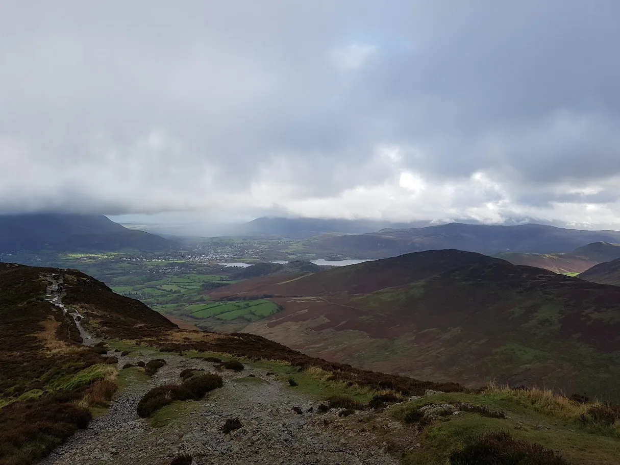
The Coledale Horseshoe is 14.8 km with 1,199 m of climb, graded Very Hard (E4·T3). Expect 160 to 215 minutes. It starts in Braithwaite, 4 km from Keswick on the X4 and X5 bus route, where there's free roadside parking that fills by 8am at weekends.
From Braithwaite you climb directly onto the north ridge of Grisedale Pike, then follow a high ridge over Hopegill Head to Crag Hill, at 839 m the highest point of the day, then along to Sail and down over Barrow back to the village. The ridges are exposed throughout and serious in strong wind. The route is marked as needing map skills, and the stretch between Crag Hill and Sail needs compass work in cloud, so carry a map and compass and know how to use them. The descent off Grisedale Pike is steep. You'll want deep-lug shoes with real grip and a windproof and waterproof layer, because there's no shelter once you're up. It's a spring to autumn route. The Royal Oak in Braithwaite is waiting at the end.
Coledale Horseshoe: route & free GPX →
Skiddaw and Blencathra via Lonscale Fell
Skiddaw and Blencathra via Lonscale Fell is a 23.2 km horseshoe with 1,412 m of climb, graded Very Hard (E4·T4). Most runners take between 3 hours 45 minutes and 5 hours 5 minutes. It starts from the free Gale Road car park above Keswick, around 2 km from the town centre.
The route traverses Lonscale Fell, with the deep trench of Glenderaterra to the east, climbs onto Skiddaw Little Man and then Skiddaw itself, the high point of the day, before crossing to Blencathra. It's a committing mountain day. The ridges are long and exposed with no shelter, navigation around Skiddaw House is serious in cloud, and some of the descents off Blencathra are steep, rocky and exposed. The route is marked as needing map skills, and its hazard notes call map and compass skills essential. There's no water on the route and no cafe until you're back in Keswick, so take food and a proper water carry. You'll also want deep-lug shoes and a windproof and waterproof layer. It's a spring to autumn route, and it shares ground with the Skiddaw Fell Race and the Skiddaw and Blencathra Fell Race.
Skiddaw and Blencathra via Lonscale Fell: route & free GPX →
Expert: the Tea Round
Abraham's Tea Round
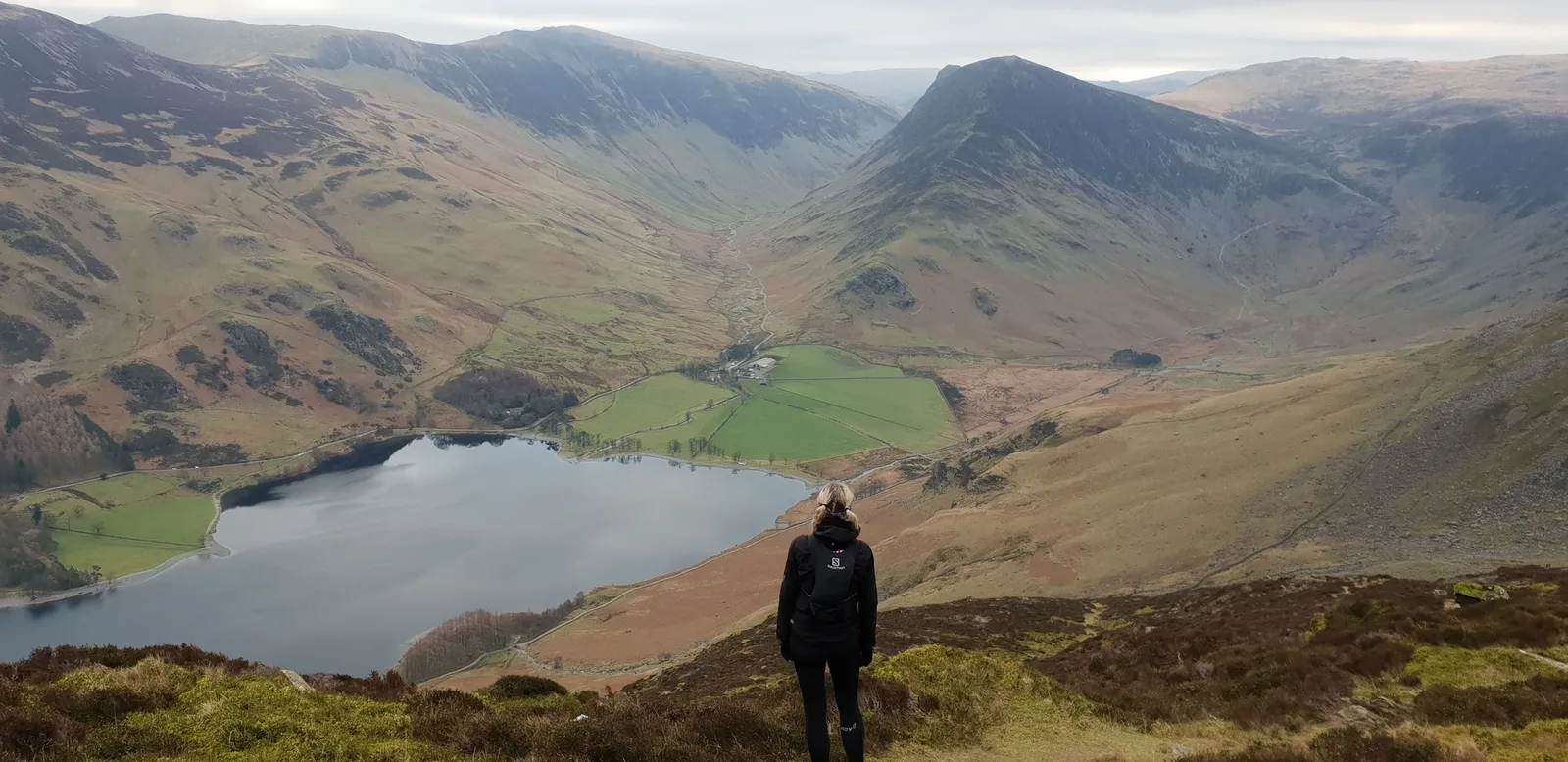
Abraham's Tea Round is 48.2 km with 3,378 m of climb, graded Expert (E5·T4). Most runners take between 8 hours 15 minutes and 11 hours 10 minutes. It starts and finishes at the doors of George Fisher in Keswick, and the challenge is simple: touch every top you can see from the window of Abraham's Cafe on the top floor. Finish it and the tea is on the house. It's run as a personal challenge with a logbook at George Fisher, not as a race.
The line follows the Cumbria Way to Catbells, heads into Newlands and over Robinson, drops to Buttermere and picks up High Stile. It then crosses to Grisedale Pike and Hopegill Head above Coledale, and returns over Crag Hill, Sail, Causey Pike, Rowling End and Barrow on one of Lakeland's finest ridges back into Keswick. Part of the same ground is raced each spring in the Coledale Horseshoe fell race.
It's a long, committing day over rough and partly pathless fells. Route-finding between the Newlands, Buttermere and Coledale groups is demanding in cloud, and there are steep, rocky descents off Robinson and Causey Pike. Carry a map and compass and know how to use them, take food and a proper water carry, and wear deep-lug shoes and a windproof and waterproof layer. It's recorded as a summer and autumn route only.
Abraham's Tea Round: route & free GPX →
Practical notes
Getting there without a car. Five of the seven routes start in Keswick itself: Latrigg, the Derwentwater Round, Catbells, Walla Crag and Castle Crag, and the Tea Round. Skiddaw and Blencathra starts around 2 km up the road at Gale Road, and the Coledale Horseshoe is 4 km away in Braithwaite on the X4 and X5. To reach Keswick, take the X4 or X5 from Penrith railway station, or the 555 from Windermere and Kendal.
Parking. Lakeside long stay in Keswick has around 250 spaces and toilets, and fills early on summer weekends. Bell Close is the other central option. Gale Road is free, with around 15 spaces. Braithwaite has free roadside parking that fills by 8am at weekends.
Terrain and mud. Mud ratings here run from 2 to 3 out of 5. The lake routes are the ones that flood: the head of Derwentwater and low Borrowdale can be ankle-deep after heavy rain.
Seasons. Latrigg, the Derwentwater Round, Catbells and Walla Crag all list winter among their best seasons. Coledale and Skiddaw and Blencathra are spring to autumn routes, and the Tea Round is summer and autumn only.
Safety. Five of the seven routes go onto open fell, and the Coledale ridges, Skiddaw, Blencathra and the Tea Round are fully exposed to weather. Check the mountain forecast for the summit height, not the valley, and read the safety page before a big day.
In an emergency call 999 or 112, ask for Police, then Mountain Rescue. If you have no signal you can text 999, but you have to pre-register first — text "register" to 999.
Kit. For Latrigg and the lake routes, a trail shoe with decent grip covers you. For Coledale, Skiddaw and Blencathra, and the Tea Round, you'll want deep-lug shoes, a windproof and waterproof layer, and a map and compass. On anything over 20 km, carry food and a proper water carry. Skiddaw and Blencathra has no water on the route at all. Our kit guides go into more detail.
Free GPX, condition reports and photos
Every route in this guide has a free GPX download on its route page, with no account and no email signup. Load it onto your watch or phone and go. If you've run one of these recently, add a condition report on the route page. It's the quickest way for the next runner to find out whether the head of the lake is flooded or the Coledale ridge is iced. For more routes across the national park, see the Lake District hub and our guide to the best Lake District trail running routes.
FAQ
Where can I run trails from Keswick?
Trail Running Planet lists seven routes from Keswick, from 8.3 km to 48.2 km. Five start in the town itself, including Latrigg, the Derwentwater Round and Catbells from Keswick. The Coledale Horseshoe starts in Braithwaite, 4 km away, and Skiddaw and Blencathra starts from the Gale Road car park above town.
What is the easiest trail run from Keswick?
The Derwentwater Round from Keswick is the easiest: a 14.6 km lap of the lake with just 21 m of climb, graded Moderate (E2·T1). For a summit, Latrigg from Keswick is an 8.3 km out-and-back with 288 m of climb, also graded Moderate.
What is Abraham's Tea Round?
Abraham's Tea Round is a Keswick fell-running challenge that starts and finishes at George Fisher and touches every top visible from the window of Abraham's Cafe on the top floor. Our route is 48.2 km with 3,378 m of climb, graded Expert. Finish it and the tea is free. It's a personal challenge with a logbook at the shop, not a race.
Can I run from Keswick without a car?
Yes. Five of the seven routes start in the town, and the Coledale Horseshoe starts in Braithwaite on the X4 and X5 bus route. Keswick has no station, but the X4 and X5 run from Penrith railway station and the 555 runs from Windermere and Kendal.
Which Keswick routes are worth running in winter?
Latrigg, the Derwentwater Round, Catbells from Keswick, and Walla Crag, Castle Crag and Derwentwater all list winter among their best seasons. Be aware that the head of Derwentwater can be ankle-deep in water in winter. The Coledale Horseshoe, Skiddaw and Blencathra, and the Tea Round are recorded as spring to autumn or summer to autumn routes.
Do I need a map and compass around Keswick?
On the big fell rounds, yes. The Coledale Horseshoe, Skiddaw and Blencathra via Lonscale Fell, and Abraham's Tea Round are all marked as needing map skills. Coledale needs compass work between Crag Hill and Sail in cloud, and the ground around Skiddaw House is serious in poor visibility.
Are the GPX files free?
Yes. Every route on Trail Running Planet has a free GPX download on its route page, with no account and no email signup required.
Every route in this guide, and the rest within 15 km, is on the Routes near Keswick page: 21 routes, each with a free GPX file and a TRP grade.