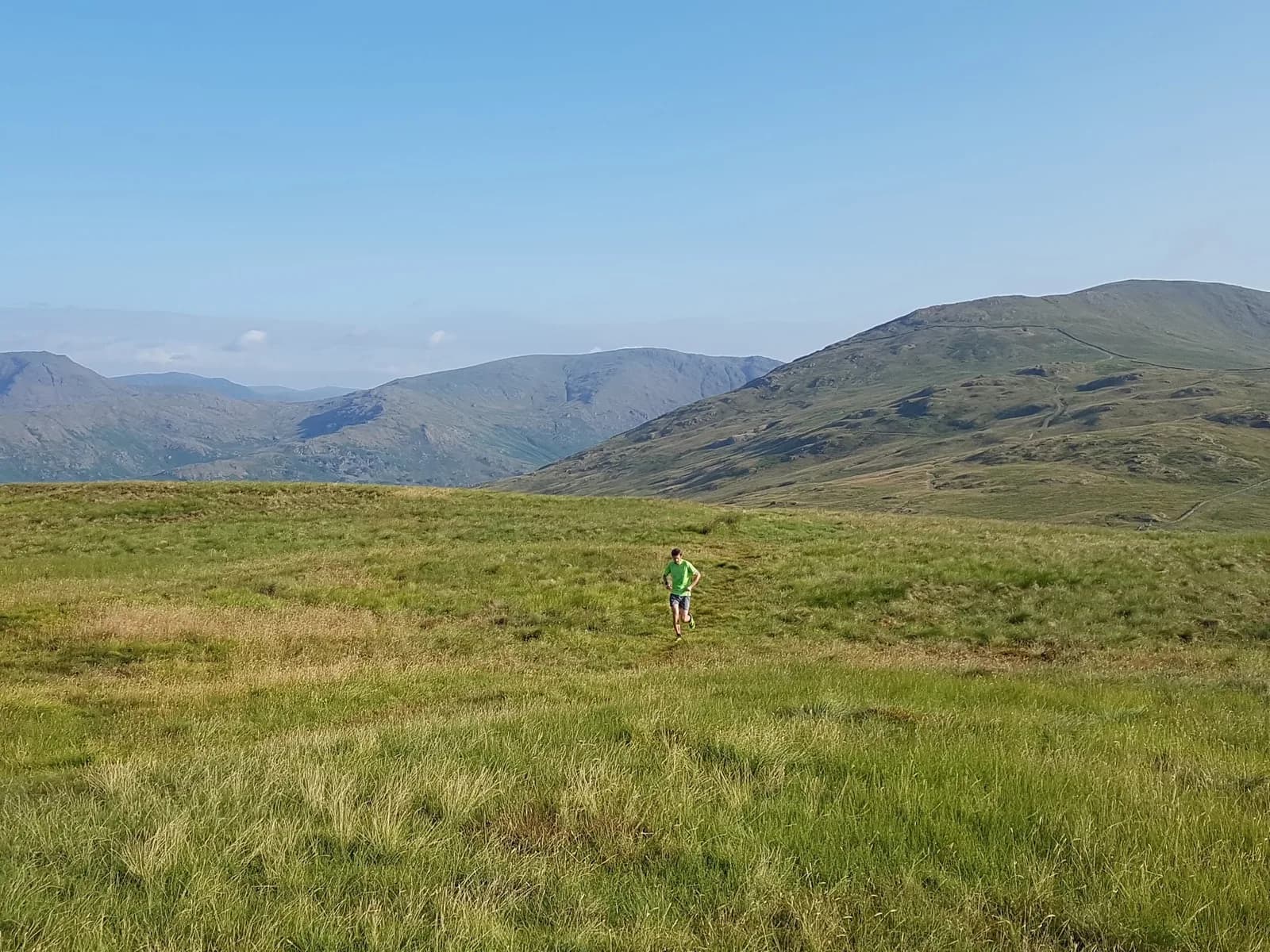
Best Trail Runs From Ambleside: 10 Lake District Routes
Ten trail routes from Ambleside, 9.8km to 36.7km, with free GPX. Honest TRP grades from Moderate to Expert, and what each one is actually like.
Ambleside gives you ten trail running routes between 9.8 km and 36.7 km, with climb ranging from 181 m to 2,856 m and TRP Grades from Moderate to Expert. Seven start in or run through the town itself, four of those within half a mile of the centre, and all ten have a free GPX file. Below is what each one is, how hard it actually is, and how to reach it — including the ones you can get to on the bus.
Why Ambleside works as a base
Ambleside sits at the head of Windermere with direct access to the central fells — Fairfield, the Helvellyn range and the quieter Troutbeck valley. That geography is why a 9.8 km lakeshore loop and a 36.7 km mountain day both start from the same postcode.
The transport is the other half of it. The Stagecoach 555 runs year-round between Kendal and Lancaster via Ambleside, and the seasonal open-top 599 connects Bowness, Windermere, Ambleside, Grasmere and Keswick. Both stop centrally. The nearest rail station is Windermere, about 9 km away, and both services link it to the town. For the routes further out, the 516 Langdale Rambler runs from Ambleside to Elterwater and the Langdales, and the Windermere ferry and Cross Lakes shuttle reach the west shore, with the 505 serving nearby Hawkshead. Every route on this page is reachable without a car.
Parking is the pinch point rather than the transport. Rydal Road car park is the start for five of these routes — pay and display, roughly £9 for a full day, chargeable 8am to 8pm, with public toilets on site. It fills early on weekends and through the summer. All ten routes have toilets at the start, and nine have water — the Wansfell round is the exception, and it is flagged below.
The ten routes at a glance
| Route | Distance | Ascent | Grade | Terrain | Type | Best for |
|---|---|---|---|---|---|---|
| Wray Castle and Claife | 9.8 km | 181 m | Moderate (E2·T1) | Path, woodland | Loop | An easy day on waymarked ground |
| Cathedral Cave from Elterwater | 11.2 km | 214 m | Moderate (E2·T2) | Woodland, path | Loop | Low, sheltered running when the fells are wild |
| Rydal Water and Loughrigg Terrace | 13.1 km | 699 m | Hard (E3·T2) | Path, woodland | Loop | Two lakes and a cave on good paths |
| Helm Crag, Calf Crag and Steel Fell | 13.4 km | 639 m | Hard (E3·T3) | Fell, path | Loop | A first proper fell round |
| Lakeland Trails Ambleside 14k | 13.8 km | 505 m | Hard (E3·T2) | Woodland, fell | Loop | Running the race route in your own time |
| Ambleside Low Level Loop | 19.6 km | 562 m | Hard (E3·T2) | Path, woodland | Loop | Distance without the fell commitment |
| Wansfell Pike, Sour Howes and Sallows | 19.6 km | 1,008 m | Very Hard (E4·T3) | Fell, moorland | Loop | Three Wainwrights from the town centre |
| Scandale Horseshoe from Ambleside | 20.6 km | 1,106 m | Very Hard (E4·T3) | Fell, path | Loop | A quiet fell round on the doorstep |
| Fairfield Horseshoe Extended | 33.1 km | 2,287 m | Expert (E5·T3) | Fell | Loop | The full ridge plus Helvellyn |
| Helvellyn Double | 36.7 km | 2,856 m | Expert (E5·T4) | Fell | Out-and-back | The biggest day the town offers |
Grades follow the TRP grading system: the higher of the effort and terrain scores sets the plain-English label.
Short and low: two easier runs a short hop out
Neither of these starts in Ambleside, and that is the honest trade. The town's own routes all sit at 13 km and above, so if you want something shorter or easier, you travel a few miles first.
Wray Castle and Claife
Wray Castle and Claife is 9.8 km with 181 m of climb — the lowest-climb route in this set and the only one graded T1. It runs the west shore of Windermere and loops back through the Claife woods, and it is waymarked throughout, which is as simple as route-finding gets around here. Typical time is 70 to 100 minutes. Parking is the Wray National Trust car park, 71 spaces, charged for non-members, payable by machine or the JustPark app with code 80715, and it fills on fine days. The catch is traffic of a different kind: the lakeshore track is shared with cyclists, busy in season, and some sections run close to deep water. On T1 ground, road shoes cope in the dry and a light trail shoe covers you the rest of the time.
Wray Castle and Claife: route & free GPX →
Cathedral Cave from Elterwater
Cathedral Cave from Elterwater is 11.2 km with 214 m of climb, 98% of it runnable, on woodland and valley paths through Little Langdale. It is low and sheltered by Lakeland standards, which makes it the route to pick when the tops are getting hammered — and it is one of only three here rated for all four seasons. Take the 516 Langdale Rambler from Ambleside. Real hazards, though: the Cathedral Quarry chambers are unlit with uneven floors and unfenced drops, so take a torch if you go inside, and wet slate and river-crossing rocks are genuinely slippery. T2 ground with roots and mud — trail shoes recommended.
Cathedral Cave from Elterwater: route & free GPX →
Straight out of the town centre
Lakeland Trails Ambleside 14k
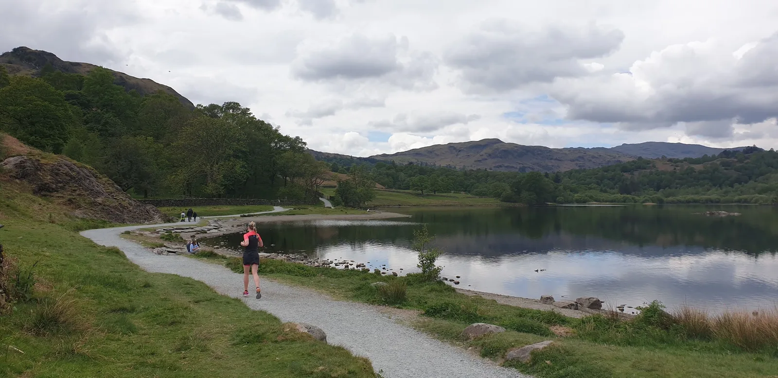
Lakeland Trails Ambleside 14k is 13.8 km with 505 m of climb, starting 0.3 miles from the centre. It climbs through Skelghyll Woods to Jenkin Crag, then finishes over Loughrigg Fell, and it is the actual Lakeland Trails race route, so you can run it as a benchmark. Grade is Hard (E3·T2), typical time 115 to 155 minutes. The honest condition: Loughrigg's web of paths confuses in cloud, and the woodland tracks are slick when wet. Carry a map for the fell section, and take trail shoes with real grip for the rocky and boggy ground higher up.
Lakeland Trails Ambleside 14k: route & free GPX →
Ambleside Low Level Loop
Ambleside Low Level Loop is the one to run when the weather is uncertain: 19.6 km and 562 m through Rydal Water, Under Loughrigg and the south shore of Grasmere, 98% runnable, and among the driest ground here at a mud rating of 2 out of 5. It starts 0.3 miles from the centre and takes 155 to 210 minutes. Grasmere sits at the midpoint with cafés and the gingerbread shop metres off the route. The drawback is company — Grasmere and Rydal draw large numbers in summer, and the river paths near Rothay Park go muddy and briefly flood after heavy rain. A light trail shoe is plenty on this one, and road shoes cope in dry weather, but at three-plus hours take food and a proper water carry rather than a handheld.
Ambleside Low Level Loop: route & free GPX →
Rydal Water and Loughrigg Terrace
Rydal Water and Loughrigg Terrace reads like a gentle lakeshore outing and mostly runs like one, but the numbers say 699 m of climb over 13.1 km, which is why it grades Hard (E3·T2) rather than Moderate. That is more climb per kilometre than the Low Level Loop. It links Rydal Water and Grasmere along Loughrigg Terrace and passes Rydal Cave, takes 120 to 165 minutes, and works all four seasons. These are honeypot paths, so expect crowds in season, and both the lakeshore and the terrace are slick when wet. Trail shoes for T2 ground; nothing more technical needed.
Rydal Water and Loughrigg Terrace: route & free GPX →
One short hop for a fell round
Helm Crag, Calf Crag and Steel Fell
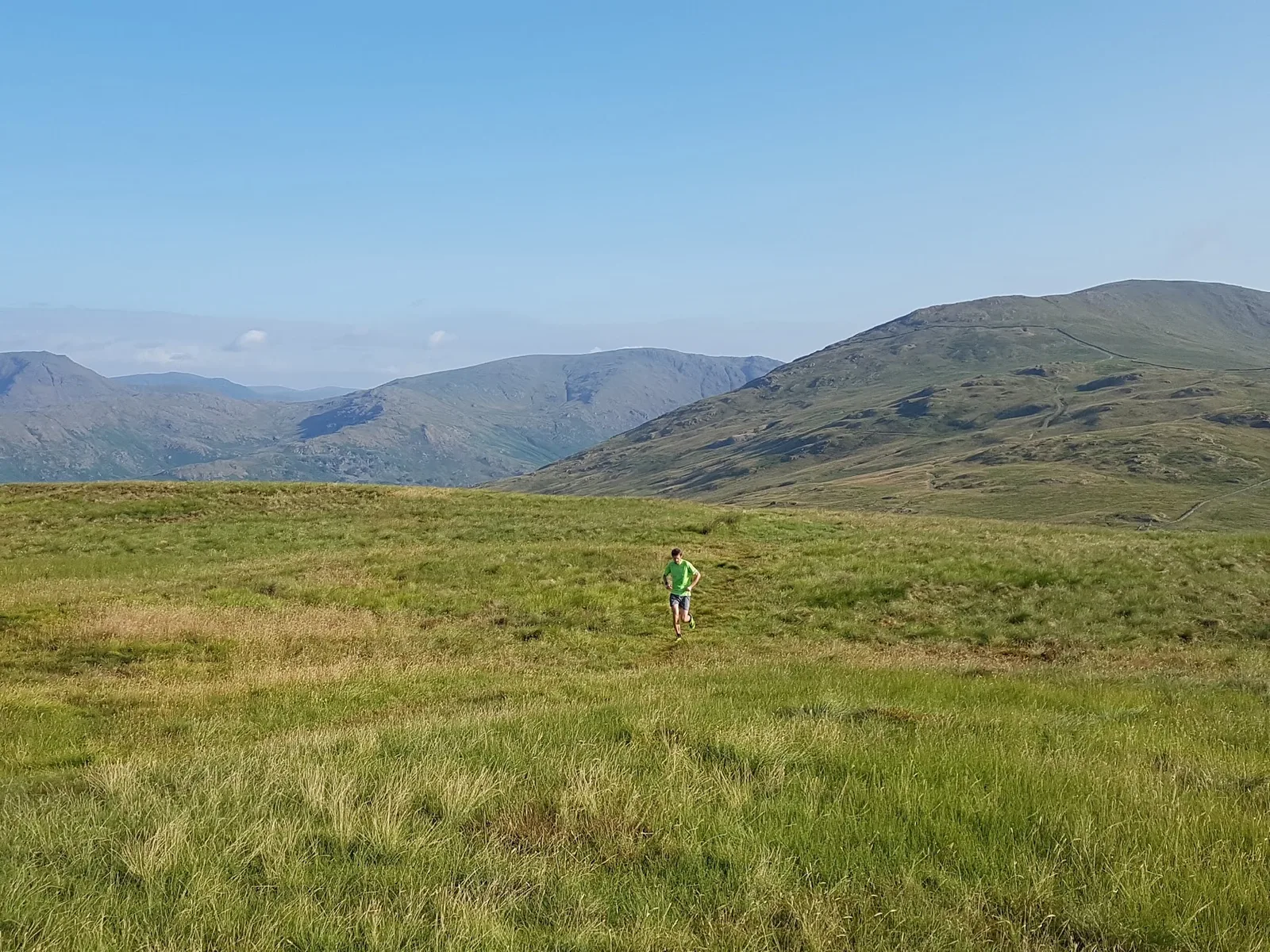
Helm Crag, Calf Crag and Steel Fell starts in Grasmere, 3.2 miles from Ambleside on the 555 or 599, and packs 639 m of climb into 13.4 km. It takes in Helm Crag at 405 m — the Lion and the Lamb rocks — then Gibson Knott at 420 m, Calf Crag at 537 m and Steel Fell at 553 m. Grade is Hard (E3·T3), 84% runnable, 120 to 165 minutes. Two honest conditions: the true summit of Helm Crag is an exposed rock scramble best left alone in the wet, and the ridge to Calf Crag is rough and boggy with junctions that confuse in cloud. This is a map-skills route — carry a map and compass and know how to use them, because phone navigation alone is not enough on that ridge. T3 ground means deep-lug shoes; a road-leaning trail shoe will let you down. The data marks it spring, summer and autumn, not winter.
Helm Crag, Calf Crag and Steel fell from Grasmere: route & free GPX →
Where the climbing starts
Wansfell Pike, Sour Howes and Sallows
Wansfell Pike, Sour Howes and Sallows is 19.6 km with 1,008 m of climb, starting 0.3 miles from the town centre — the same distance as the Low Level Loop with nearly twice the vertical. It takes three Wainwrights: Wansfell Pike at 484 m, Sallows at 516 m and Sour Howes at 483 m. Very Hard (E4·T3), 88% runnable, 180 to 245 minutes. The climb onto Wansfell Pike is steep on a badly eroded path that turns slippery in the wet, and the grassy tops of Sour Howes and Sallows are boggy and largely pathless, so map skills matter in cloud. This is the one route here with no water on the route — carry everything you need. The fells are fully exposed, so take a windproof and waterproof layer; there is no shelter once you are up. Spring to autumn.
Wansfell Pike, Sour Howes and Sallows from Ambleside: route & free GPX →
Scandale Horseshoe from Ambleside
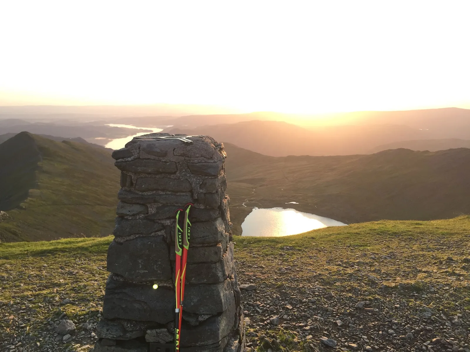
Scandale Horseshoe from Ambleside is 20.6 km and 1,106 m, starting 0.4 miles from the centre, up the quiet valley behind the town and back along the ridge. Very Hard (E4·T3), 190 to 260 minutes. It is the neighbour to the Fairfield Horseshoe and sees a fraction of the traffic, which is the point of it. It also carries the wettest ground in this set, a mud rating of 4 out of 5, so deep-lug shoes rather than anything road-leaning. The high ridges and Scandale Pass are exposed and confuse in cloud — carry a map and compass — and there are steep, rough sections with loose ground on the tops. Take a windproof and waterproof layer, plus food and a proper water carry for four hours out. Spring to autumn.
Scandale Horseshoe from Ambleside: route & free GPX →
Long days out
Fairfield Horseshoe Extended
Fairfield Horseshoe Extended is 33.1 km with 2,287 m of climb: the full horseshoe ridge from Nab Scar over Heron Pike, Great Rigg, Fairfield at 873 m, Hart Crag, Dove Crag, High Pike and Low Pike, plus a detour over Grisedale Hause to tag Helvellyn at 949 m and back. Expert (E5·T3), and the typical time range is 335 to 455 minutes — five and a half to seven and a half hours. For reference, Ambleside AC run the Fairfield Horseshoe Fell Race here each May over the classic 14.5 km, 914 m course, which is less than half the climb of this version.
Two things to plan around. Fairfield's summit plateau is flat, featureless and easy to get turned around on in cloud, with unguarded drops close to the path on the north and west sides. And the Grisedale Hause link to Helvellyn is loose underfoot and adds a serious amount of remote, high ground with no easy bail-out once you are committed to it. Map and compass, a windproof and waterproof layer, and food and a proper water carry. Spring to autumn only.
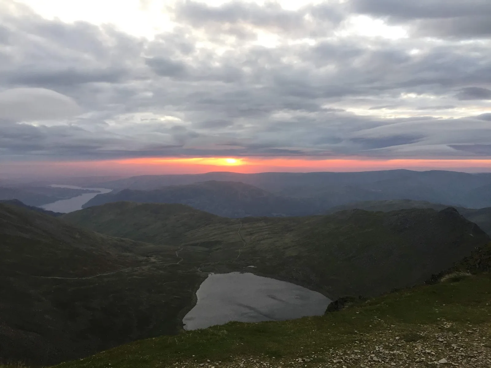
Fairfield Horseshoe Extended: route & free GPX →
Helvellyn Double
Helvellyn Double is the biggest route from Ambleside: 36.7 km with 2,856 m of climb, taking 390 to 530 minutes — six and a half to nearly nine hours. It runs out over Nab Scar, Heron Pike, Great Rigg and Fairfield, crosses Grisedale Hause to Helvellyn, and comes back the same way, which is why it carries more climb than the longer-sounding horseshoe extension despite covering less ground. Expert, and at T4 it is the most technical ground in this set: steep rough descents, deep bog, faint paths and navigation needed in poor visibility.
Grisedale Hause is loose scree in both directions and sits a long way from any easy escape route. Fairfield's flat summit is disorientating in cloud and this route crosses it twice — the second time on tired legs. Treat it as a mountain ultra: full nav kit, mountain shell, and real food. The data marks it spring to autumn, and it is not a dog route — the Grisedale Hause scree is hard on paws in both directions.
Helvellyn Double: route & free GPX →
Practical notes
Parking. Rydal Road in Ambleside serves the Low Level Loop, Wansfell, Scandale, Fairfield Extended and Helvellyn Double — pay and display, around £9 for a full day, chargeable 8am to 8pm, toilets on site, and it fills early on weekends and in summer. Overflow parking in Rydal village. Kelsick Road and the National Trust car park at Waterhead are the other Ambleside options. White Moss on the A591 is the natural start for Rydal Water and Loughrigg Terrace; Broadgate Meadow serves Helm Crag from Grasmere; Elterwater village and Walthwaite Bottom serve Cathedral Cave; Wray National Trust car park serves Claife.
Transport. The 555 and 599 cover Ambleside, Grasmere, Rydal and White Moss, which between them serve eight of these ten routes. The 516 Langdale Rambler reaches Elterwater for Cathedral Cave, and the ferry, Cross Lakes shuttle and 505 reach the west shore and Hawkshead for Wray Castle.
Terrain and mud. Scandale is the wettest, rated 4 out of 5 for mud. The Low Level Loop and the two Expert routes sit at 2, the rest at 3. Three routes are rated for all four seasons — Wray Castle and Claife, Cathedral Cave from Elterwater, and Rydal Water and Loughrigg Terrace. The other seven are marked spring to autumn.
Kit, town-wide. The pattern here is simple. The two Moderate routes and the Low Level Loop run on good path where a light trail shoe is plenty. Everything from Helm Crag upwards is T3 or T4 fell ground where deep lugs, a windproof and waterproof layer, and a map and compass stop being optional — five of the ten need real map skills. Anything over three hours needs food and a proper water carry, and Wansfell has no water on the route at all. Category guidance rather than product picks lives in the TRP kit guides.
Weather and safety. Six of these routes touch open fell or moorland where the weather changes fast and shelter does not exist.
In an emergency call 999 or 112, ask for Police, then Mountain Rescue. If you have no signal you can text 999, but you have to pre-register first — text "register" to 999.
More on planning and conditions at TRP safety.
Free GPX, condition reports and photos
Every route on this page has a free GPX file on its route page. No account, no email gate, no paywall — download it and go. If you run one and find the ground has changed, a path has been diverted or a river crossing is worse than described, send us a condition report from the route page. Photos of the actual routes are welcome too, and so are route submissions if you know ground around Ambleside we have not covered. More Lake District routes are on the Lake District hub.
FAQ
Where can I run trails near Ambleside?
Ambleside has ten mapped trail running routes within five miles, ranging from 9.8 km to 36.7 km. Seven start in or run through the town, including the Ambleside Low Level Loop, the Lakeland Trails Ambleside 14k, Wansfell Pike, Scandale Horseshoe, Fairfield Horseshoe Extended and Helvellyn Double — four of them within half a mile of the centre. The other three start a short bus or drive out at Grasmere, Elterwater and Wray Castle.
What is the easiest trail run near Ambleside?
Wray Castle and Claife, at 9.8 km with 181 m of climb, is the easiest route in the set. It is graded Moderate (E2·T1), the ground is waymarked, and typical time is 70 to 100 minutes. It starts three miles from Ambleside on the west shore of Windermere, reachable by the Windermere ferry and Cross Lakes shuttle.
What is the toughest trail run from Ambleside?
Helvellyn Double, at 36.7 km with 2,856 m of climb and a typical time of six and a half to nearly nine hours. It is graded Expert (E5·T4) and crosses Fairfield's featureless summit plateau twice, with a loose scree crossing at Grisedale Hause in both directions and no easy escape route. Fairfield Horseshoe Extended is close behind at 33.1 km and 2,287 m.
Can I run trails near Ambleside without a car?
Yes, all ten routes are reachable by public transport. The year-round Stagecoach 555 and the seasonal open-top 599 both stop centrally in Ambleside and serve Grasmere, Rydal and White Moss. Windermere station is about 9 km away and connected by both services. The 516 Langdale Rambler reaches Elterwater for Cathedral Cave, and the ferry, Cross Lakes shuttle and 505 bus reach the west shore for Wray Castle.
Which routes near Ambleside are worth doing in winter?
Three routes are rated for all four seasons: Wray Castle and Claife, Cathedral Cave from Elterwater, and Rydal Water and Loughrigg Terrace. Cathedral Cave is the most sheltered of them, running low through Little Langdale woodland when the tops are getting hammered. The seven others are marked spring to autumn, and Helvellyn Double in particular becomes a different proposition in winter conditions.
Do I need map skills for the fell routes above Ambleside?
Five of the ten routes are rated as needing map skills: Helm Crag, Wansfell Pike, Scandale Horseshoe, Fairfield Horseshoe Extended and Helvellyn Double. On those, carry a map and compass and know how to use them — phone navigation alone is not enough when Fairfield's summit plateau or the Sour Howes grassland is in cloud. The other five are marked straightforward or waymarked.
Are the GPX files free?
Yes. Every route on Trail Running Planet has a free GPX download on its route page, with no account and no email required.
How busy do these routes get?
Rydal Water and Loughrigg Terrace, the Ambleside Low Level Loop and the Wray Castle lakeshore are the busiest — honeypot paths through Grasmere, Rydal and the west shore that draw large numbers in summer. Starting early buys you both quiet and a parking space. Scandale Horseshoe and the Sour Howes and Sallows section of the Wansfell route are the quietest ground in the set.
Every route in this guide, and the rest within 15 km, is on the Routes near Ambleside page: 31 routes, each with a free GPX file and a TRP grade.